Site tour
Full Bend day
Bridge stop and Visegrád
- Length9.5 hours
- Bridge stop15 minutes
- Visegrád105 minutes
Choose your stop
The quick version
The classic Danube Bend panorama lookout is the Visegrád Citadel terrace; for more effort climb Prédikálószék, and for a tower or a dome try the Zsitvay lookout or Esztergom Basilica.
Plan your view
Check out 39 stops
Start by picking a route; tap a pin or stop for its note and Google Maps.
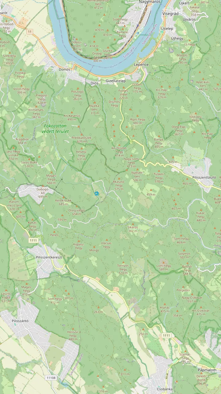
A 639-metre andesite rock, the tallest of the hills around Visegrád.
Google MapsVolcanic rock towers on the side of Prédikálószék, in a strictly protected zone: stay on the trail.
Google MapsA volcanic gorge with ladders, one-way uphill from Dömös; over 60,000 visitors a year.
Google MapsThe highest point of the Visegrád Hills, about 700 metres.
Google MapsA 7-metre lookout on the 587-metre Bölcső Hill, reached by an 800-metre steep path.
Google Maps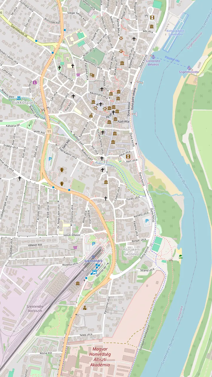
The triangular main square where the roads from Buda, Visegrád and the Pilis meet; the Merchants' Cross in the middle dates from 1763.
Google MapsThe Serbian Orthodox bishop's church, begun in 1762 and consecrated in 1764; closed in winter, entry fee.
Google MapsChurch Hill, with the town's oldest church and a stone sundial from the 1300s on its buttress.
Google MapsOver 300 works by the ceramic artist, on show since 1973; copies in the last room may be touched.
Google MapsA former 19th-century sawmill, opened to art in June 1999, with large temporary shows.
Google MapsThe museum centre in the 18th-century Pajor Mansion, renamed in 2016.
Google MapsThe suburban train from Batthyány tér in Budapest ends here.
Google MapsA designated Danube bathing site with a 2026 permit.
Google Maps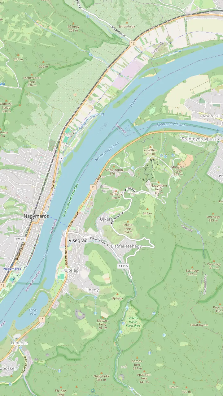
The hilltop castle with the Holy Crown exhibition; adult ticket HUF 2,800.
Google MapsThe palace of the Angevin kings below the castle; winter hours Tuesday to Sunday 8:00-16:00.
Google MapsThe 13th-century residential tower of the lower castle; the museum lists it as closed.
Google MapsRemains of a Roman camp of the 320s on a 176-metre hill.
Google MapsA 1933 lookout tower on the 378-metre Nagyvillám; adult ticket HUF 850.
Google MapsThe car ferry to Nagymaros and its railway station leaves from here.
Google Maps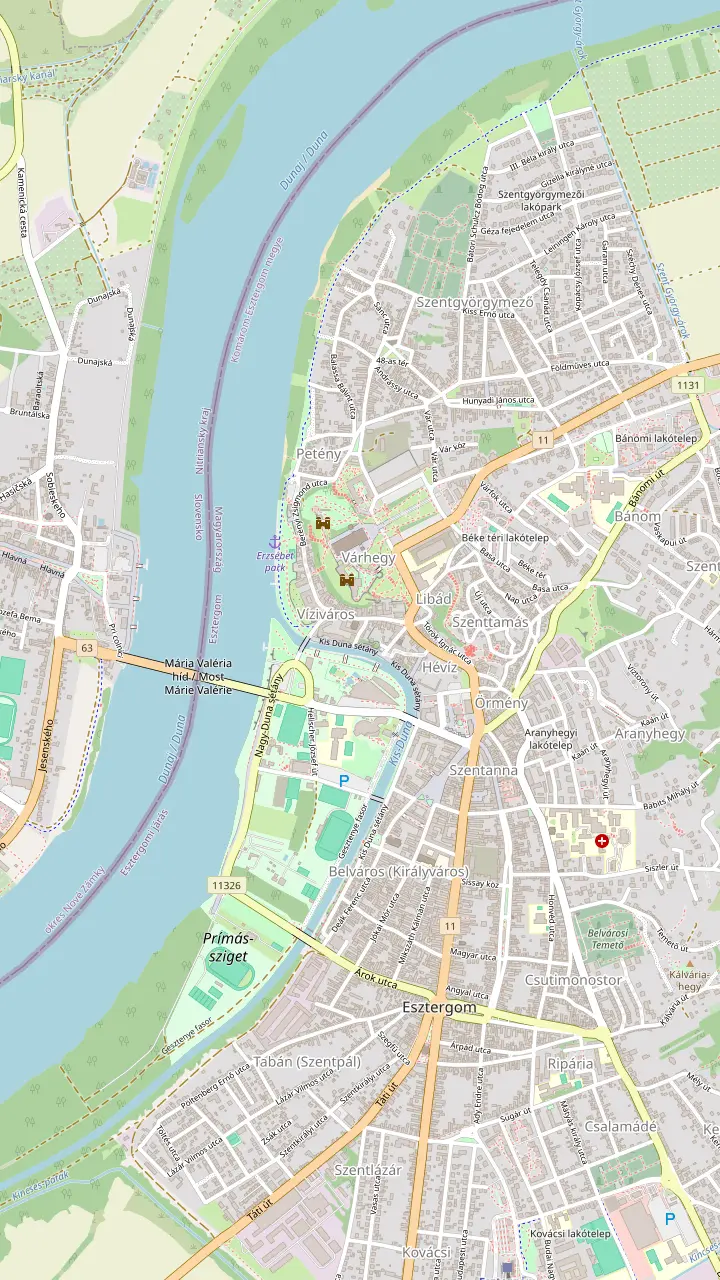
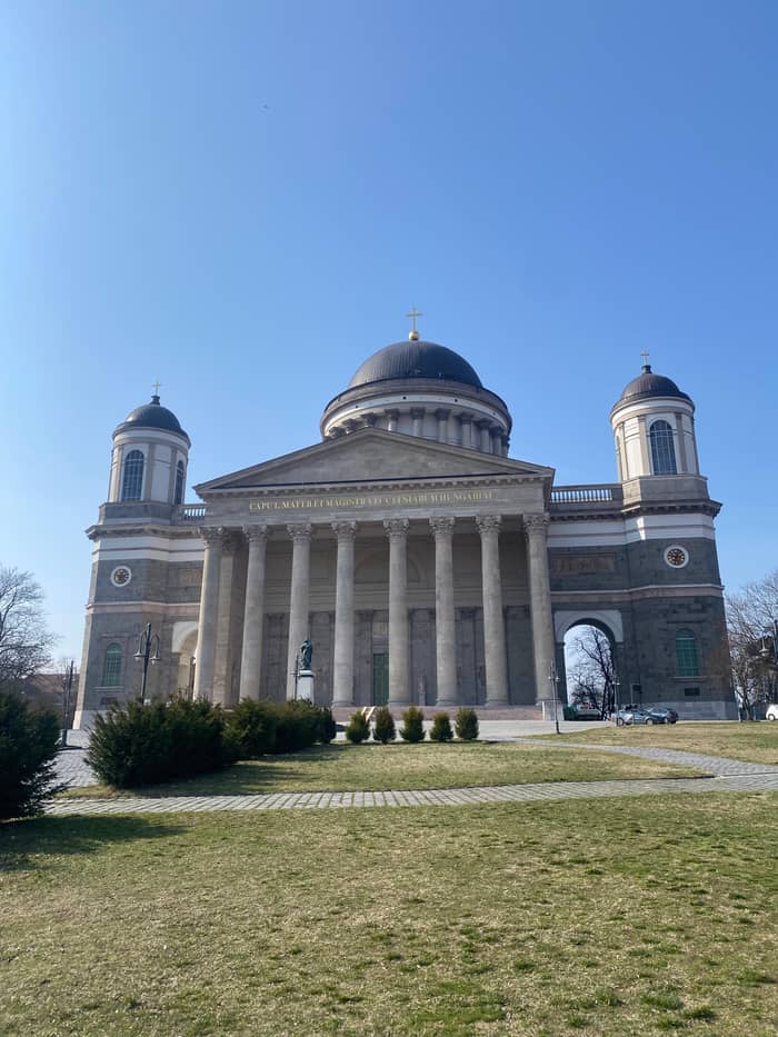
Hungary's largest church, 100 metres high; entering the church is free.
Google MapsThe royal castle museum next to the basilica, walls in places over 800 years old.
Google MapsThe bridge to Štúrovo in Slovakia, seen from the basilica's dome.
Google MapsOne of the largest church libraries in Hungary, completed in 1853 to plans by József Hild.
Google MapsThe water museum whose Vízeum exhibition won exhibition of the year in 2020.
Google MapsA promenade on maps since 1769, linking the Water Town with Castle Hill.
Google Maps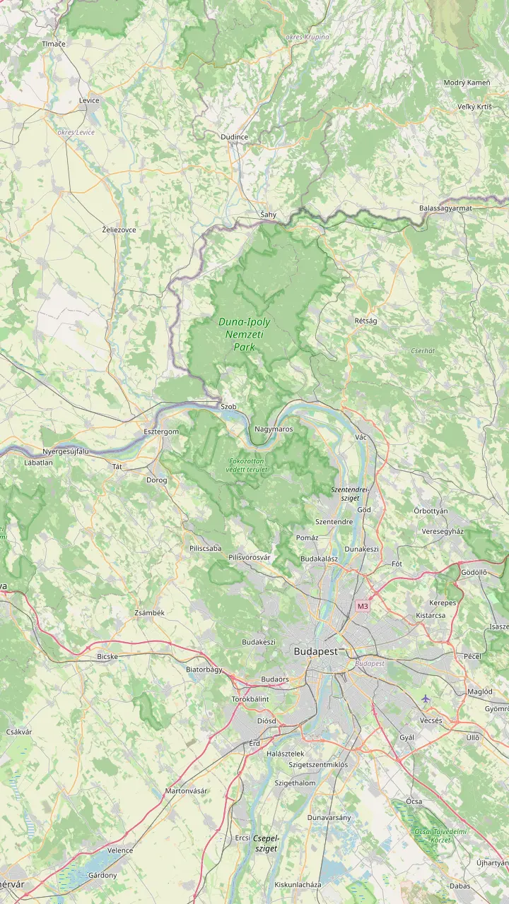
The open-air museum of village buildings, with almost 400 buildings; closed for winter from 2 November.
Google MapsThe oldest holiday resort of the Bend, 27 km north of Budapest.
Google MapsVillage with the Forgó beach, a designated bathing site in 2026.
Google MapsThe northern tip of Szentendre Island, with sand dunes and open beaches.
Google MapsStarting point for the Rám Gorge and the steeper path up Prédikálószék.
Google MapsAcross from Visegrád by ferry, with a designated beach on Hunyadi sétány.
Google MapsVillage of the painter István Szőnyi, whose house has been a museum since 1967.
Google MapsA train stop on the left bank with a designated Danube beach.
Google MapsA town with a Baroque main square, a cathedral and a riverside promenade.
Google MapsThe Slovak town across the Mária Valéria Bridge from Esztergom.
Google Maps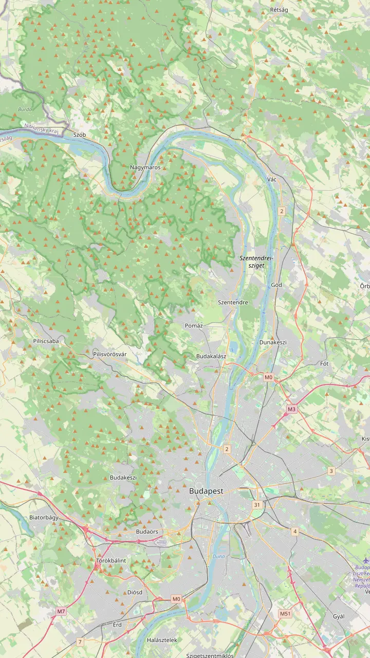
Start of the suburban train line to Szentendre.
Google MapsScheduled boats leave here for Visegrád between May and October.
Google MapsLong-distance buses to Visegrád leave from Árpád Bridge.
Google MapsTrain station on the left bank facing Visegrád, linked by ferry.
Google MapsMap © OpenStreetMap contributors
A Danube Bend panorama lookout turns a river trip into one picture: water bending around volcanic hills. Here are the viewpoints, how to reach each, which you see on the day tour and when the light is right.
Editorial team, danubebendtour.com · Updated November 8, 2026 · Allow 8 min
Summary view
From river level the Danube Bend is pretty; from a hilltop it makes sense. The river arrives from the west, hits a wall of volcanic hills and swings south towards Budapest, and only from height can you see the whole curve at once. That is why every good lookout sits on the right-bank hills around Visegrád or on the slopes across the water. Climb any of them and the map in your head suddenly lines up with the landscape.
The national park directorate explains the shape. The Visegrád Hills are volcanic, born in violent eruptions about 20 million years ago, while the neighbouring Pilis is limestone and dolomite.5 In the Ice Age the river sawed a passage through this volcanic barrier, splitting the hills apart, an event the directorate calls the largest change to river courses in the Carpathian Basin.6 The viewpoints are the walls of that breach.
The best views come in pairs: a rock or tower on the hills, and the river below with Nagymaros or Visegrád on the far bank. Some are a short walk from a car park, some sit on top of a museum, and some take a half-day hike. Below they are sorted by effort, with the opening times and tickets that the operators publish, so you can pick the right Danube Bend viewpoint for your day and your legs.
Pick your view
| Viewpoint | Getting there | What you see |
|---|---|---|
| Visegrád Citadel | Panorama road or footpath | Town and river below the walls |
| Zsitvay lookout | Car park and 10-minute walk | Up to 100 km on clear days |
| Prédikálószék | Hike from Dömös or Pilisszentlászló | Visegrád, Nagymaros, Börzsöny |
| Basilica dome | 400 steps in Esztergom | Bridge, Štúrovo, the Bend |
| Bölcső Hill | 800-metre steep path | A small renovated lookout |
Access and views as the operators and the tourism agency describe them.1,12,18,19,20,4,21
The classic view is from the Citadel above Visegrád. Hungary's tourism agency ranks this panorama among the country's most famous.1 The castle stands on a hill 328 metres high, so the river and the town lie almost directly beneath the walls.11 Look upstream to see the river arriving, then downstream to Nagymaros and the islands where it widens again. Walk the full circuit of the walls, because each side frames a different stretch of water.
Getting there is easy by Danube Bend standards. Drivers use the panorama road, and in season a weekend shuttle bus runs up the hill.12,13 The terrace is inside the ticketed castle: under the 2024 price list, adults pay HUF 2,800, students and pensioners HUF 1,400.14 From April to September it opens daily 9.00-18.00, and the ticket office closes half an hour earlier.15,16 Your ticket also covers the exhibitions inside, so allow longer if you want the exhibitions too.
Come in the late afternoon if you can. The sun swings behind the castle and lights the Börzsöny across the river, which gives the warmest colours and the least haze. Morning works too, when mist lies on the water and the hills stand out in layers. The terrace is busy in summer at midday, when tour groups arrive, so either end of the day gives you more room. A small lens cloth is worth packing, because the wind on the walls carries dust and spray from the valley.
Higher up, on Nagyvillám, stands the Zsitvay lookout, raised in 1933 on the summit of Nagyvillám, 378 metres high, and listed as a monument in 2005.9 It was raised for the 20th anniversary of the Hungarian Tourist Association and first called the Jubilee lookout.24 The tower adds a little height to the hill, and from the top you can pick out the Mátra, the Pilis and the Zsámbék Basin on a clear day.19
The view reaches far. On clear days you see the capital and up to 100 km around, and the town council says the Bend itself shows even in cloudy weather.19 You can drive the panorama road to the car park below and walk 10 minutes up, or hike about an hour from Visegrád on the blue trails.18 Beside the lookout runs a 700-metre bobsled track, which children will want to try.25 Combine the tower with the Citadel and you have the two classic views of Visegrád in one morning.
Plan around the hours. Monday is its day off; on other weekdays it welcomes visitors 11:00-16:00, and on Saturdays and Sundays 10:00-17:00.26 Adults pay HUF 850, pensioners HUF 550 and young people from 6 to 18 HUF 450, and children under 6 go free.3 In winter it shuts in icy weather, so check before a cold-weather trip.27 Weekend afternoons in spring and autumn are the busiest times, while a weekday morning often gives you the platform to yourself.
Choose your lookout
Pick by time, fitness and transport.
If I am on the coach tour
The bridge stop and Visegrád
15 minutes at the bridge, 105 at Visegrád.
If I have a car and an hour
The Zsitvay lookout
Park below and walk 10 minutes.18
If I want a real hike
Prédikálószék from Dömös
A 639-metre rock above the river.2
If I want a building with a view
The Esztergom dome
400 steps to a view over Slovakia.4
If I want a base for forest trails
Dobogókő
A starting point for many scenic routes.22
Ways to the views
Site tour
Bridge stop and Visegrád
On foot
Walk up to the Citadel
Left bank
Left-bank hills by train
For walkers, the big prize is Prédikálószék, a huge andesite rock 639 metres high and the tallest of the hills around Visegrád.2 From the clearing on top you look straight down on the river, with Visegrád and its castle on your side and Nagymaros and the Börzsöny peaks opposite. The path from Dömös is steeper; the one from Pilisszentlászló is gentler.2 Either way, budget a good half day and start early in summer, before the heat builds on the open rock.
On the way up from Dömös you pass the Vadálló Rocks, towers of volcanic agglomerate with names like the Exclamation Mark and Árpád's Throne.67 Prédikálószék and the rocks are a strictly protected part of the Duna-Ipoly National Park, so stay on the marked trail and leave the flowers alone.54 The climb is steep and rocky in places, so bring proper shoes and plenty of water, and turn back if rain makes the rock slippery.
Further south, Dobogókő tops the Visegrád Hills at roughly 700 metres.17 Hungarians love it, and on a fine weekend the paths around the summit are full of walkers. The tourism agency describes it as a much-loved peak and a starting point for many scenic trails.22 Its height makes it a natural base for longer walks, and the shaded forest paths around it are pleasant on hot days; the view looks out over wooded ridges rather than straight down onto the bend.
Price your day
Enter your group to see the coach day and both guided hikes side by side.
Compare 3 choices
Enter your group to see the coach day and both guided hikes side by side.
≈
View≈
View≈
ViewConverted at the ECB reference rate, from-prices as listed by GetYourGuide. The precise amount is shown when you book.
How the views were made
20 million years ago
The Visegrád Hills form in a short burst of volcanism.5
1.5 million years
The Danube carves its way between the hills.7
1250-1260
Béla IV builds the Visegrád castle.8
1933
A tower rises on Nagyvillám.9
2021
The old lookout near Szentendre is rebuilt.10
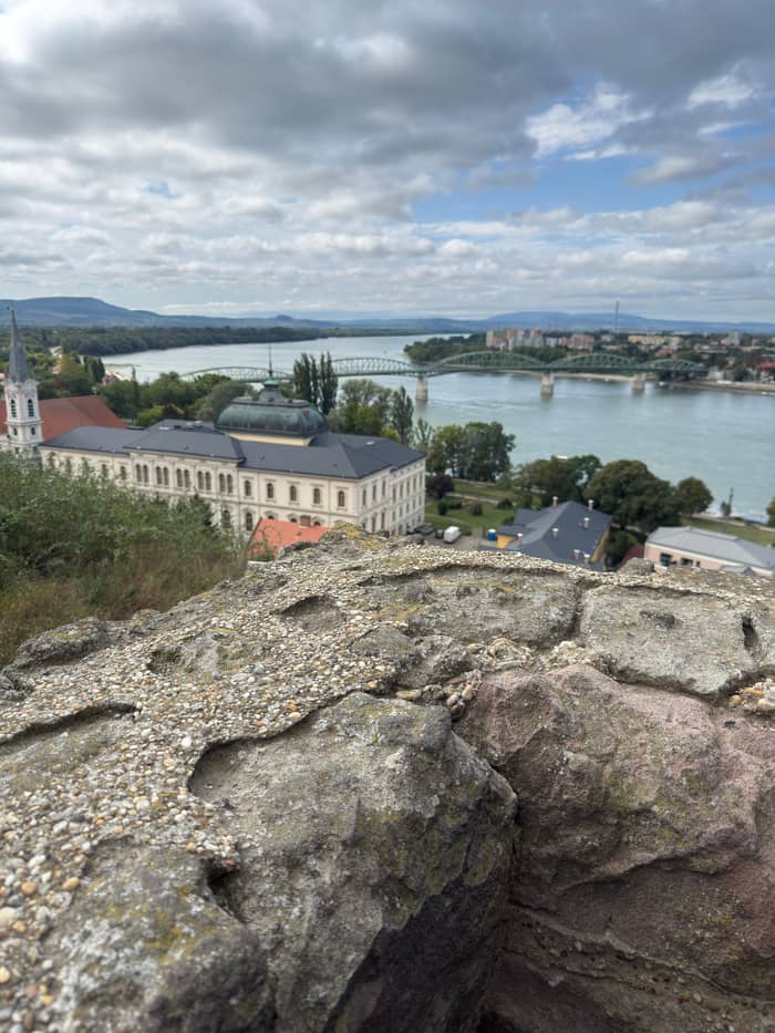
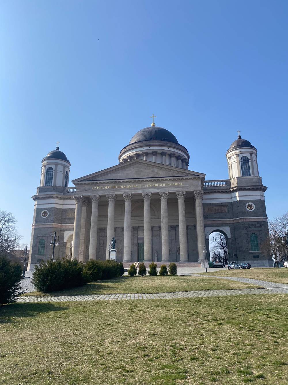
At the western end of the Bend, Esztergom has the highest building view. Climb the 400 steps of the basilica dome and the lookout takes in the town and its bridge, the Slovak town of Štúrovo opposite and the curve of the river, with the distant Tatras when the air is clear.4 The dome ticket is HUF 3,300 at full price.66 The climb is long, so pace yourself, and keep your camera ready for the open gallery near the top, where the whole river valley appears at once.
Mind the season. In the 2026 summer season the dome kept 9:00AM to 6:00PM hours, and from 1 November 2026 it closes at 4:00 PM with tickets sold until 3:00 PM.68,69 In mid-winter it can close altogether: it was shut from 12 January to 27 February 2026.70 Next door, the castle museum's White Tower offers another high view, out to the hills on clear days.23 Check both before a winter visit.
The best photograph of the basilica itself is taken from below, not from inside it. The day tour sold on this site stops for 15 minutes at the Mária Valéria Bridge, a natural place for that picture. The tourism agency also suggests the old coal loading tower in the Danube at Esztergom as a photo spot.71 Walk out onto the bridge for the classic shot of the hill above the water.
Video
Smooth Adventure on YouTube · The video waits until you tap play to load.
The panorama from the White Tower is breathtaking, and in clear weather you can also admire the surrounding mountains.
For the photographers
Closer to Budapest, the lookout on Bölcső Hill between Szentendre and Pomáz sits at 587 metres and was renovated in 2021.10 Its builders carried the beams up by hand to spare the forest.72 It is only 7 metres tall, and the easiest approach is an 800-metre path on the green triangle trail, short but steep, so wear proper shoes.10,21 Pair it with an afternoon in Szentendre's old town, which lies close by, and you have a full and varied day.
For a view at water level, go to Kisoroszi at the northern tip of Szentendre Island, where sand dunes and open beaches face Visegrád across the river.59 The tourism agency lists the island tip among its favourite photo spots.71 Here the water splits around the island, and the castle hill rises straight ahead, which makes it a fine sunset spot in summer. Bring a picnic and stay until the castle walls catch the last light.
Across the river, the left bank has its own lookouts. Zebegény's village trail leads up to a viewing point above the bend.73 Deeper in the Börzsöny, a newer tower on Castle Hill above Királyrét looks over the Börzsöny, the Pilis, the Naszály and the Cserhát.74 These are quieter than Visegrád and reward anyone with a car and a free afternoon, and the walk up to the Zebegény lookout fits easily between lunch and the train home.
On this site's featured coach tour, your guaranteed views are the Mária Valéria Bridge photo stop and the scenic views listed at Visegrád, where the stop lasts 105 minutes with lunch. Ask your guide where the group eats and whether there is time to walk up; routes change with the season. Prédikálószék, Dobogókő and the Zsitvay lookout need your own car, a hike or a separate tour.
For Danube Bend photos, go when the air is clear. Autumn mornings bring mist in the valley and colour on the slopes, while spring gives fresh green and long evenings. Summer haze softens distant views, so aim for early or late in the day. Winter can be beautiful after snow, but check opening days for the Citadel and the dome first, since both cut their hours.75,70 A polarising filter helps with glare off the water at midday.
If you would rather follow someone who knows the way, a hike from Budapest climbs to the Visegrád castle in 80 minutes from Szentgyörgypuszta and spends an hour at the top. On the left bank, a nature day from Budapest-Nyugati walks from Zebegény to Nagymaros for about 4 hours. Both give you views a coach tour cannot reach, at a slower pace and with a guide who knows the paths and the best places to stop.
FAQ
The tourism agency calls the view from the Citadel one of Hungary's most famous panoramas.1
Drive the panorama road to the car park, then walk 10 minutes up.18
Weekday hours from Tuesday are 11:00-16:00; Saturday and Sunday 10:00-17:00.26
The dome climb in Esztergom has 400 steps to the top.4
The tour stops there for 15 minutes before Esztergom.
It lies in a strictly protected zone of the park, so stay on the marked trail.54
Sources
Planning a day up the river? Ask a real person here.