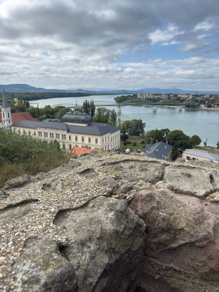
Site tour
Full Bend day
Esztergom, Visegrád, Szentendre
- Length9.5 hours
- TownsEsztergom to Szentendre
- Lunch3 courses in Visegrád
Choose your stop
Check out 39 stops
Start by picking a route; tap a pin or stop for its note and Google Maps.
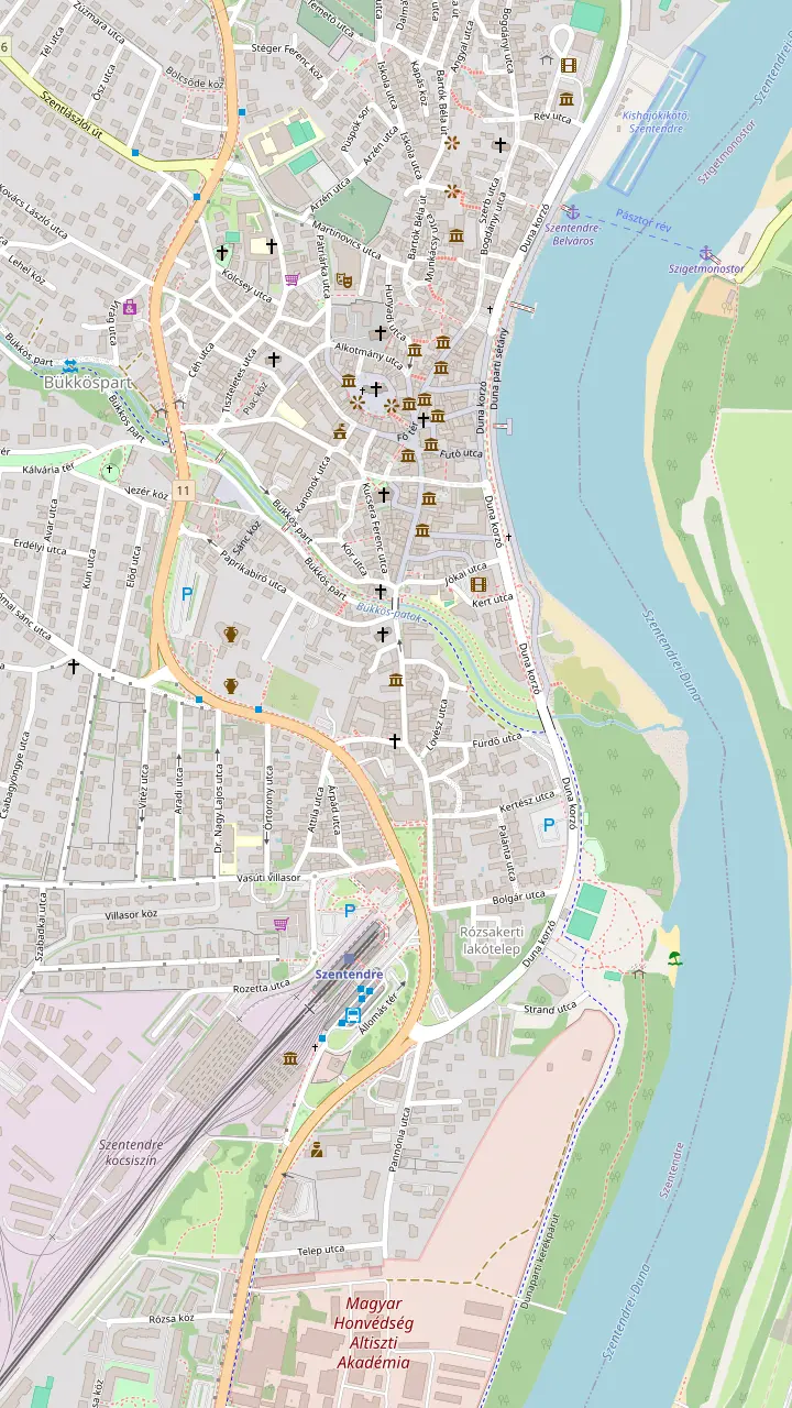
The triangular main square where the roads from Buda, Visegrád and the Pilis meet; the Merchants' Cross in the middle dates from 1763.
Google MapsThe Serbian Orthodox bishop's church, begun in 1762 and consecrated in 1764; closed in winter, entry fee.
Google MapsChurch Hill, with the town's oldest church and a stone sundial from the 1300s on its buttress.
Google MapsOver 300 works by the ceramic artist, on show since 1973; copies in the last room may be touched.
Google MapsA former 19th-century sawmill, opened to art in June 1999, with large temporary shows.
Google MapsThe museum centre in the 18th-century Pajor Mansion, renamed in 2016.
Google MapsThe suburban train from Batthyány tér in Budapest ends here.
Google MapsA designated Danube bathing site with a 2026 permit.
Google Maps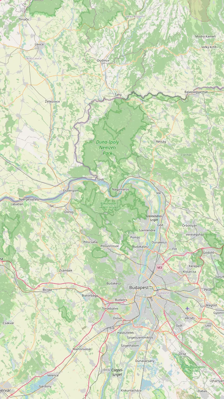
The open-air museum of village buildings, with almost 400 buildings; closed for winter from 2 November.
Google MapsThe oldest holiday resort of the Bend, 27 km north of Budapest.
Google MapsVillage with the Forgó beach, a designated bathing site in 2026.
Google MapsThe northern tip of Szentendre Island, with sand dunes and open beaches.
Google MapsStarting point for the Rám Gorge and the steeper path up Prédikálószék.
Google MapsAcross from Visegrád by ferry, with a designated beach on Hunyadi sétány.
Google MapsVillage of the painter István Szőnyi, whose house has been a museum since 1967.
Google MapsA train stop on the left bank with a designated Danube beach.
Google MapsA town with a Baroque main square, a cathedral and a riverside promenade.
Google MapsThe Slovak town across the Mária Valéria Bridge from Esztergom.
Google Maps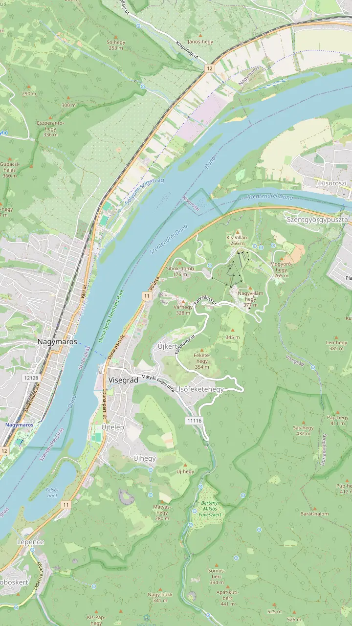
The hilltop castle with the Holy Crown exhibition; adult ticket HUF 2,800.
Google MapsThe palace of the Angevin kings below the castle; winter hours Tuesday to Sunday 8:00-16:00.
Google MapsThe 13th-century residential tower of the lower castle; the museum lists it as closed.
Google MapsRemains of a Roman camp of the 320s on a 176-metre hill.
Google MapsA 1933 lookout tower on the 378-metre Nagyvillám; adult ticket HUF 850.
Google MapsThe car ferry to Nagymaros and its railway station leaves from here.
Google Maps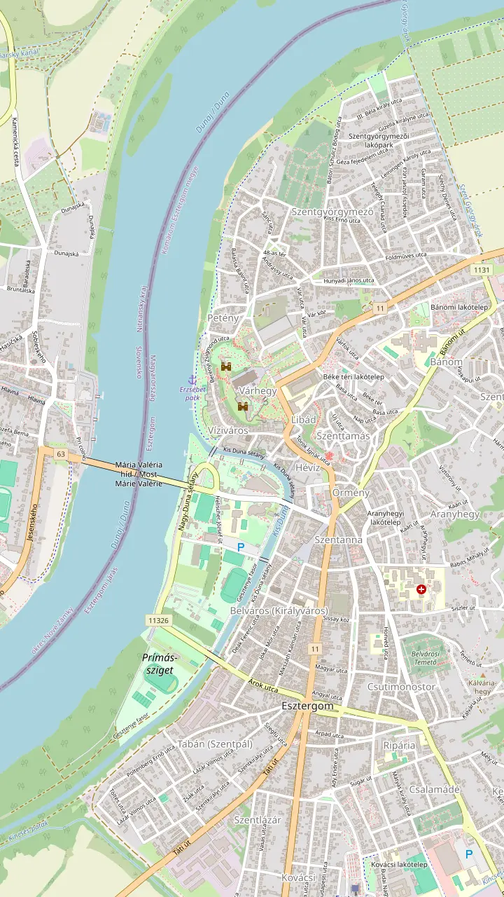
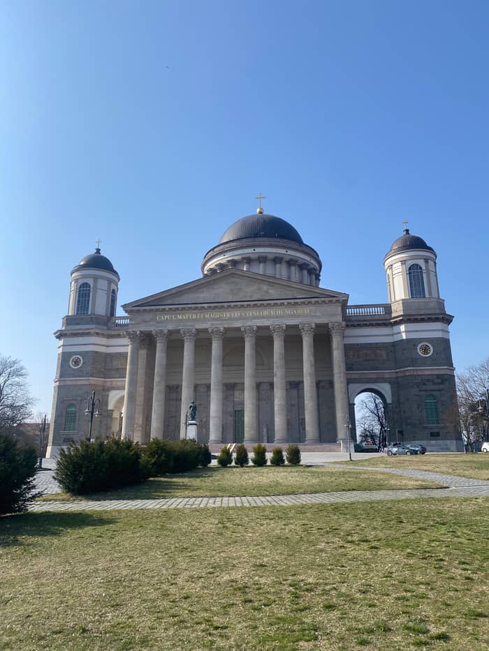
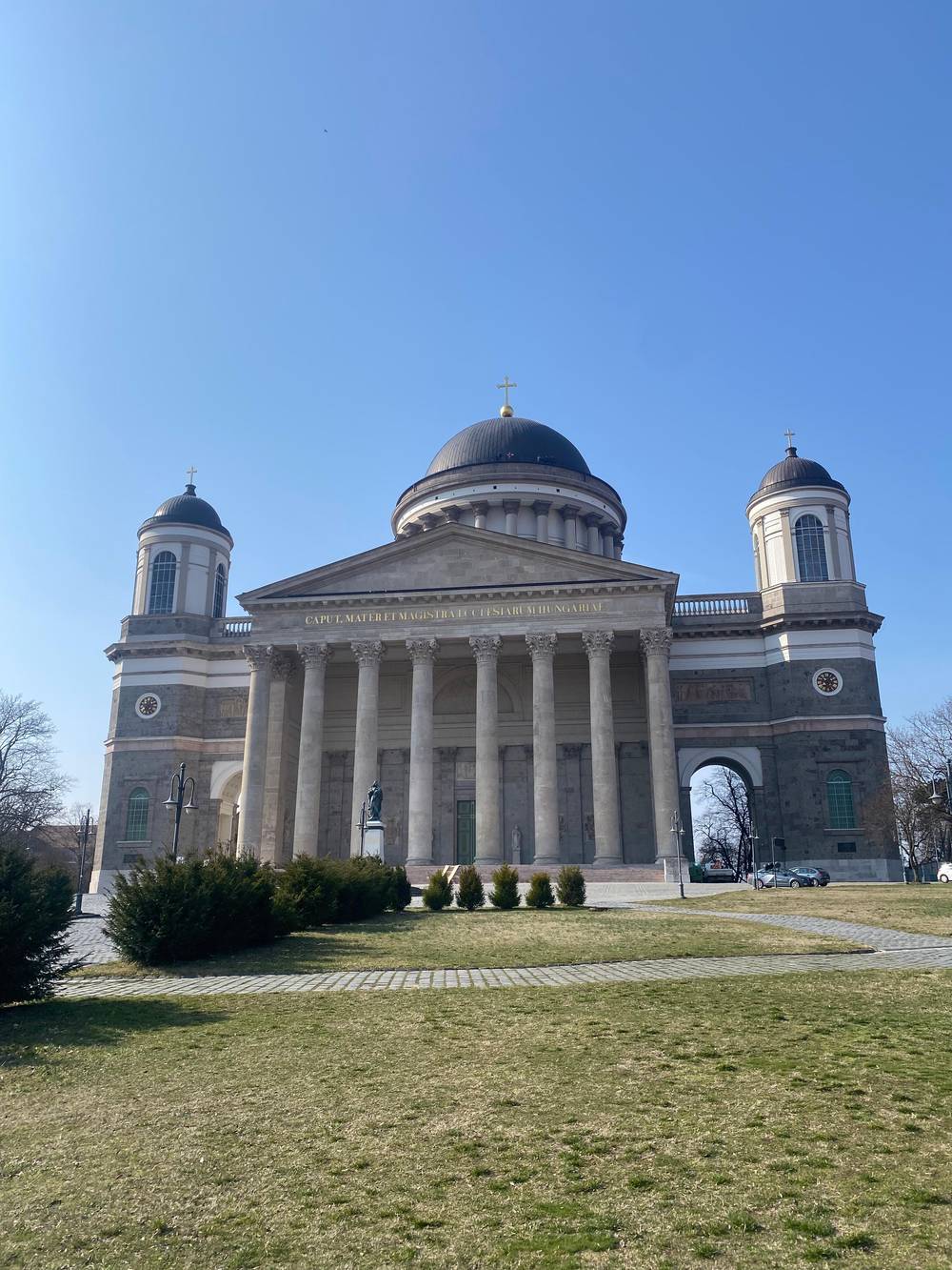
Hungary's largest church, 100 metres high; entering the church is free.
Google MapsThe royal castle museum next to the basilica, walls in places over 800 years old.
Google MapsThe bridge to Štúrovo in Slovakia, seen from the basilica's dome.
Google MapsOne of the largest church libraries in Hungary, completed in 1853 to plans by József Hild.
Google MapsThe water museum whose Vízeum exhibition won exhibition of the year in 2020.
Google MapsA promenade on maps since 1769, linking the Water Town with Castle Hill.
Google Maps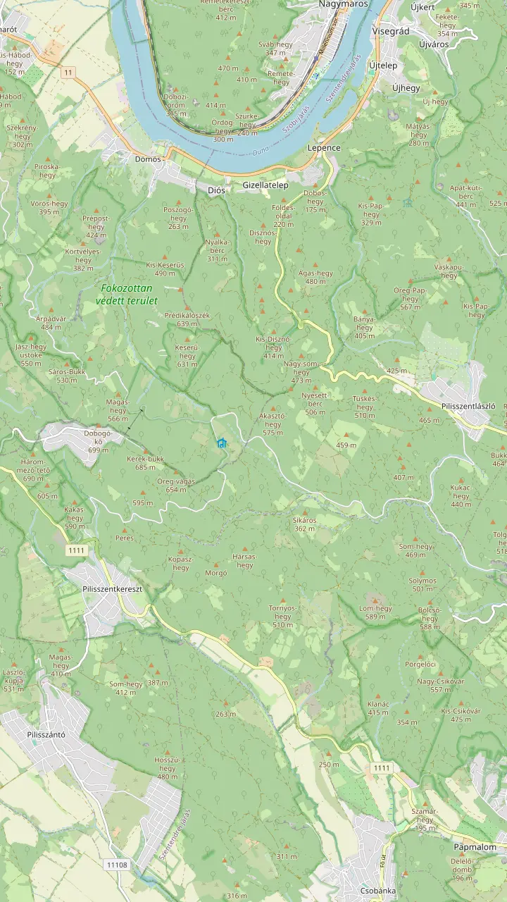
A 639-metre andesite rock, the tallest of the hills around Visegrád.
Google MapsVolcanic rock towers on the side of Prédikálószék, in a strictly protected zone: stay on the trail.
Google MapsA volcanic gorge with ladders, one-way uphill from Dömös; over 60,000 visitors a year.
Google MapsThe highest point of the Visegrád Hills, about 700 metres.
Google MapsA 7-metre lookout on the 587-metre Bölcső Hill, reached by an 800-metre steep path.
Google Maps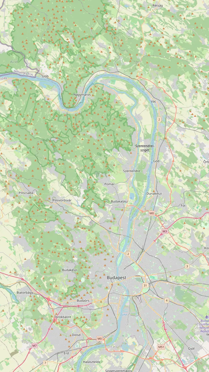
Start of the suburban train line to Szentendre.
Google MapsScheduled boats leave here for Visegrád between May and October.
Google MapsLong-distance buses to Visegrád leave from Árpád Bridge.
Google MapsTrain station on the left bank facing Visegrád, linked by ferry.
Google MapsMap © OpenStreetMap contributors
This Danube Bend map puts every riverside town on one screen, from Szentendre and Visegrád to Esztergom, Vác and the quiet villages between, with how the bend formed and how to reach each place.
Editorial team, danubebendtour.com · Updated November 8, 2026 · Allow 8 min
Summary view
What is the Danube Bend? It is the stretch north of Budapest where the Danube, Europe's second largest river after the Volga, meets a wall of hills, squeezes through a narrow valley and swings south towards the capital.5 Hungarians call it Dunakanyar. The national park that protects it covers the river between Göd and Esztergom, from river kilometre 1670 to 1720.6 In everyday use the name covers the whole area, river, hills and towns together.
On the ground that means a ribbon of towns about an hour from Budapest, each with its own character. The tourism agency names Visegrád, Szentendre and Esztergom among the cultural highlights within an hour of the city.7 Between them lie villages that most visitors never see, riverside resorts, ferry crossings and forest paths into the hills. The map further down this page puts all of them together.
Use the panels to move around. The towns panel shows both banks at once, so you can see why Visegrád and Nagymaros face each other across the water and why Esztergom looks straight at Slovakia. The other panels zoom in on the old town of Szentendre, the castle hill at Visegrád, the basilica hill at Esztergom, the lookouts in the hills and the stations and piers in Budapest where a day trip starts.
Who is where
| Place | Bank | Known for |
|---|---|---|
| Szentendre | Right | Serbian churches and museums |
| Leányfalu | Right | The oldest resort of the Bend |
| Visegrád | Right | Citadel and royal palace |
| Dömös | Right | Start of the Rám Gorge |
| Esztergom | Right | The basilica |
| Vác | Left | Baroque square and cathedral |
| Verőce | Left | Train stop and beach |
| Nagymaros | Left | Ferry to Visegrád |
| Zebegény | Left | Szőnyi's house and a lookout |
| Štúrovo | Left, in Slovakia | Across the bridge from Esztergom |
Places as the national park, the town councils and the tourism agency describe them.12,22,23,24,25,26,27,28,29,30
The bend is the result of volcanoes and patience. The Visegrád Hills were built by eruptions about 20 million years ago, during a burst of volcanism that lasted around a million years.14 The national park directorate describes the Danube's breakthrough between the volcanic Visegrád Hills and the Börzsöny in the Pleistocene as the largest change in river courses in the Carpathian Basin.1
Once through, the river kept cutting. Over nearly 1.5 million years it sank deeper into the hard volcanic rock, leaving old terraces behind as flat-topped hills.15 Nagy-Villám, Kis-Villám and the castle hill at Visegrád are such remnants.16 Today the highest point of the Visegrád Hills, Dobogókő, is only about 700 metres high, while the Börzsöny across the river reaches 939 metres at Csóványos.17,18
The river is still at work. In the narrow section it speeds up, then spreads out, so new sandbanks and islands keep forming between Nagymaros and Vác.19 To the south the hills on the right bank were long known simply as the Pilis; geologists now separate the limestone Pilis from the volcanic Visegrád Hills to its north.20 Standing at any viewpoint, you can trace that history in the shape of the land.
Heading upstream from Budapest on the right bank, the first of the Danube Bend towns is Szentendre, some 22 to 25 km north of the capital.2,3 Its Mediterranean lanes and Orthodox steeples come from refugee families from the Balkans, Serbs, Dalmatians and Greeks, who settled here in 1690.12 Next comes Leányfalu, 27 km from Budapest at the foot of the Visegrád Hills, which calls itself the oldest and best-loved holiday resort of the Bend.21,22
Further north, Dunabogdány has a designated river beach, the Forgó, on the 2026 bathing list.33 Then the valley narrows and Visegrád appears, just over 40 km from Budapest, crowned by its Citadel on a 328-metre hill.4,34 A little upstream, Dömös is the starting point for the Rám Gorge, walked one-way uphill from the village.24 On this stretch the road runs close to the water, so the drive itself is part of the pleasure, with the castle appearing and disappearing behind the bends.
At the far end stands Esztergom, where Saint Stephen was crowned around the year 1000 and where the basilica now rises 100 metres high.10,25 It marks the western gate of the Bend: beyond it the river runs along the Slovak border into open country. Most day tours visit Esztergom first and then work their way back downstream towards Budapest. If you drive yourself, doing the same saves you from heading into the low sun on the way home.
Choose your towns
Each stretch of the river has its own mood.
If I want the classic three
Esztergom, Visegrád, Szentendre
That is the line of the full-day tour.
If I want quiet villages
Nagymaros and Zebegény
Easy by train on the left bank.31
If I want Baroque streets
Vác
A Baroque square and riverside promenade.26
If I want sand and river
Kisoroszi island tip
Dunes and open beaches facing Visegrád.32
If I want to cross a border
Štúrovo from Esztergom
Walk over the Mária Valéria Bridge.30
Ways to see the towns
Site tour
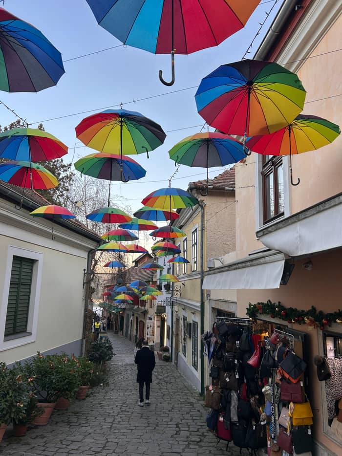
Esztergom, Visegrád, Szentendre
Boat return
Same towns, boat back
By river
River trip to Visegrád
The left bank is quieter and greener, backed by the forests of the Börzsöny. Vác has a Baroque main square, a cathedral and a riverside promenade that the tourism agency calls a pleasant surprise for many visitors.26 Further upstream, Verőce, Kismaros and Nagymaros all have railway stations, with the hills rising behind the river.31 This side suits travellers who prefer walking, swimming and slow lunches to castles and crowds, and it is easy to combine with a ride on the ferry.
Nagymaros faces Visegrád directly, and a ferry crosses between them.28 Its riverside beach on Hunyadi sétány is a designated bathing site, as is the beach at Verőce.27 From Kismaros, a narrow-gauge forest railway, built in 1893, climbs into the Börzsöny to Királyrét.13 It is a good way into the hills without a car, and a fun one for children; check the timetable before you travel, since forest lines rarely run all day.
Zebegény, upstream of Nagymaros, is the village of the painter István Szőnyi, who lived there from 1924 until his death; his house and studio have been a museum since 1967.67 The village walk climbs to a lookout over the Bend.68 Across from Esztergom, the left bank belongs to Slovakia: Štúrovo is reached from Esztergom over the Mária Valéria Bridge.30 Bring your passport or identity card if you plan to walk across.
Price your day
Say how many are travelling to price the coach and boat days.
Compare 3 choices
Say how many are travelling to price the coach and boat days.
≈
View≈
View≈
ViewConverted at the ECB reference rate, from-prices as listed by GetYourGuide. The precise amount is shown when you book.
The Bend through time
1st century AD
Ulcisia Castra guards the river at Szentendre.8
320s
A fort rises on Sibrik Hill.9
1000
Saint Stephen is crowned in Esztergom.10
1323
Charles I settles at Visegrád.11
1690
Refugees rebuild Szentendre.12
1893
A line climbs from Kismaros into the Börzsöny.13
Between the two banks lies Szentendre Island, long and flat, splitting the Danube into a main channel and the narrower Szentendre branch. The tourism agency notes that the water on the Szentendre branch is calmer and the banks more intimate.69 Parts of the island belong to the national park, and its riverside meadows feel far from the traffic on the main roads.70 Cyclists and walkers have the island largely to themselves on weekdays.
At the northern tip of the island, Kisoroszi has sand dunes and open beaches where the river splits in two, with Visegrád straight across the water.32 The tourism agency lists it as a photo spot.71 The village is small, green and pleasantly unhurried, and it makes a peaceful half day away from the castle crowds. In summer, bring a picnic and stay for the evening light on the hills opposite.
The island also explains the map's odd shapes. From the road along the right bank you often see the island's trees rather than the main river, which can make the map hard to read on the ground. Switch to the satellite view in Google Maps when you need to see the water. When you plan a riverside walk or a paddle, check on the map which channel you are next to: the main channel carries the big ships, the branch is the place for slower water.
Video
Drone's eye view on YouTube · The video waits until you tap play to load.
Vác’s Baroque main square, cathedral and riverside promenade are a delightful surprise for many visitors.
Using the map
The river was a border long before it was a holiday area. The national park directorate notes that the Bend served as a frontier of the Roman Empire.72 Szentendre was the Roman fort of Ulcisia Castra, and for more than 400 years from the 1st century AD it guarded one of the most threatened sections of the frontier line.8,73 A Roman Lapidarium between Szentendre's centre and the main road keeps the memory of that time.8
Remains of that frontier dot the map. On Sibrik Hill above Visegrád stand the ruins of a Roman camp built in the 320s under Constantine I.9 In Leányfalu, the remains of a Roman watchtower were excavated in 1963 in the village centre.74 Look for the small signs and display panels near the river road: most sites are low walls, but together they trace the line the legions watched across the water.
From the Árpád era the same hills held Hungary's church and royal centres at Esztergom and Visegrád.72 Esztergom saw the coronation of Saint Stephen, and in 1323 Charles I moved the royal seat to Visegrád.10,11 It is a lot of history for a short stretch of river, and every town along it holds a piece. Reading the map with that in mind turns a scenic drive into a journey through the country's past.
Our featured full-day tour follows the classic line: a pause for photos at the bridge to Štúrovo, 80 minutes in Esztergom, 105 minutes in Visegrád with lunch and 80 minutes in Szentendre. It does not stop in Vác, Nagymaros, Zebegény, Leányfalu, Dömös or Kisoroszi. Those places need a second day, a car or the train. That is not a flaw of the tour: no single day can cover both banks without turning into a blur of car parks.
Reaching them is not hard. Szentendre has its own suburban line from Batthyány tér, long-distance buses for Visegrád leave from Árpád Bridge, and trains serve the left-bank villages.46,66,31 From Nagymaros the ferry takes you across to Visegrád.28 Between May and October, scheduled boats from Vigadó tér in Budapest add a slow, scenic option.65 Check return times carefully before you set out, and keep a train home as your backup plan.
A good plan for a second day is to take the train to Nagymaros, cross to Visegrád for the castle, and return by boat; or to spend a slow day in Vác and Zebegény on the left bank. Use the towns panel on the map to see what lies where, then the zoomed panels for the details. Each pin carries a Google Maps link, handy for finding the pier, the station or the trailhead on your phone once you arrive.
FAQ
It formed when the river cut a path through a ring of volcanic hills.1
Smaller places include Leányfalu, Dömös, Nagymaros, Zebegény and Verőce.31
Nagymaros faces it on the left bank, linked by ferry.28
It lies across the Mária Valéria Bridge from Esztergom.30
It visits Esztergom, Visegrád and Szentendre.
Szentendre was the Roman fort of Ulcisia Castra on the frontier.73
Sources
Planning a day up the river? Ask a real person here.